Managing historic buildings to assess their preservation status and plan maintenance is a crucial aspect of historical preservation. Fortunately, the Scan-to-BIM method offers a solution to this challenge. This technique enables the creation of parametric models within a BIM environment, enhancing the accuracy of representing building components and incorporating diverse types of data.
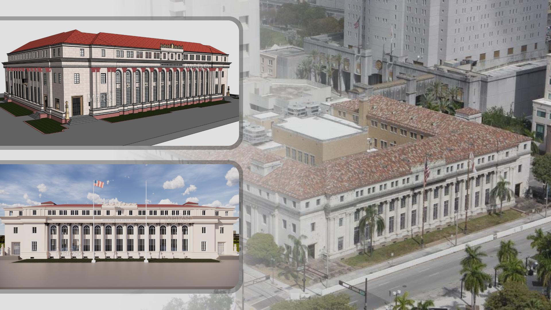
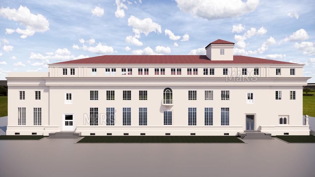
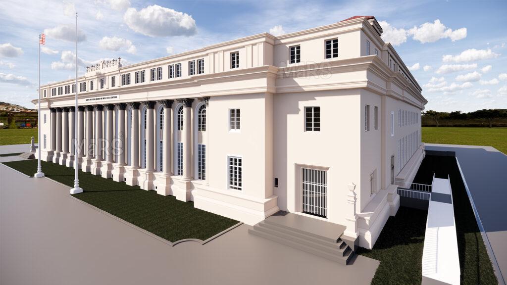
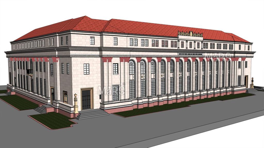
The David W. Dyer Federal Building and U.S. Courthouse in Miami is a historic structure constructed in 1931, covering an area of 179,000 sq. ft. Miami-Dade College (MDC) took on a big project to fix up and make the old David W. Dyer U.S. Courthouse better. This courthouse was built in 1933 and got special recognition in 1983 for being a historic place. But, it had been empty since 2008. The courthouse has three floors, a kind of basement, and a half-floor in the middle. Miami-Dade College wanted to give this old building a new purpose by changing about 162,250 sq. ft. of it.
They turned some of it into classrooms, places for events, libraries, spots for students to work together, offices, and other things for the college. They also had to make some changes to the building’s structure to make it work for these new things. So, this project didn’t just bring the old courthouse back to life, it also gave it a new job as a modern place for education and other college stuff.
During the reconstruction phase, which will take about 16 months, they’re going to completely change the Dyer Building. They want to turn it into a place that fits the plans Miami-Dade College has for their educational needs. They use a Laser Scanning process to make sure they get every detail right. This process creates a super-precise 3D map of the building, like a digital copy.
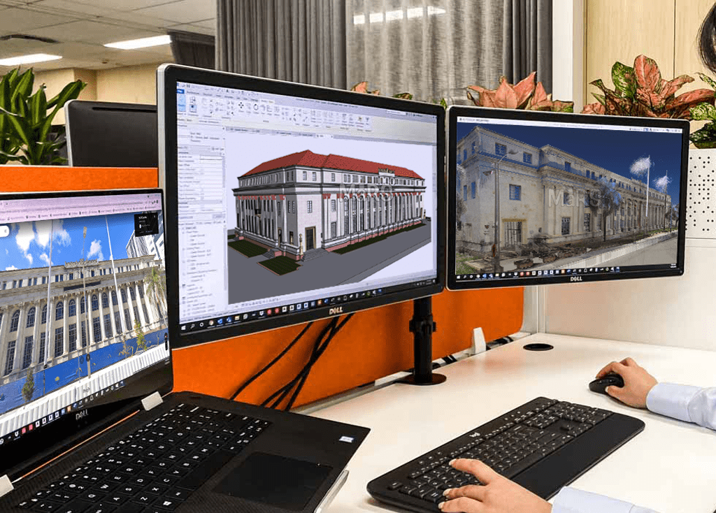
After completing the laser scanning process, a client approaches MaRS Trans USA for a Scan to BIM development. They takes on the task of creating a Revit model for BIM coordination from the scanned data. This process involves using digital scans provided by the client to transform the building’s point cloud data into a Revit model. This helps everyone involved in the project understand exactly how things should be built or rebuilt, making the whole process smoother and more precise.
How is Scan to BIM technology helpful in such projects?
Building Information Modeling (BIM) technology has gained popularity in the fields of archaeology, architecture, and cultural heritage, especially when it comes to the 3D digitalization of historic structures, or Heritage BIM (HBIM). Since it offers a framework for continuing upkeep and activities, HBIM is crucial for maintaining cultural assets. The “Scan-to-BIM” workflow manages modeling, surveying, and information management while creating intelligent models from large data sets that can be useful for HBIM projects in the future.
Technology Used
1. 3D Survey and Data Processing
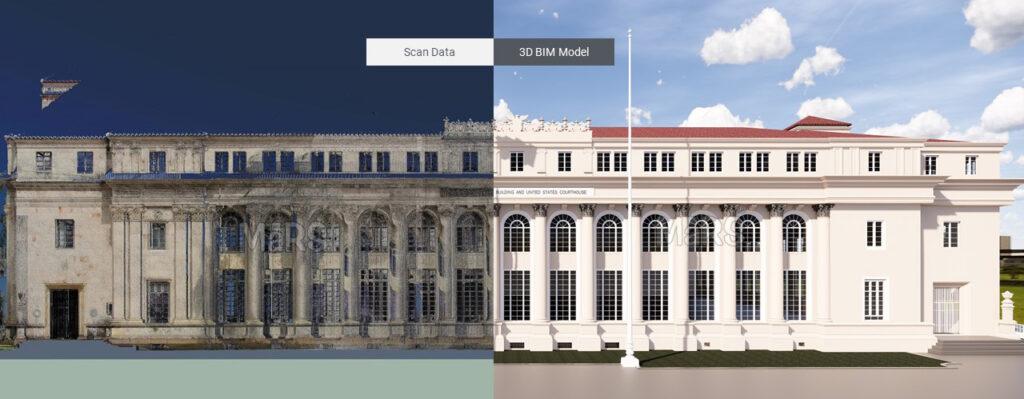
For the digital renovation of the Federal building, point cloud laser scanning technology was used to provide a precise and complete image of the existing architecture. For this project, the LOD 400 was utilized in the Revit model since it aids in defining the project’s scope and prevents over- and under-modeling.
By scanning the surface of an object, 3D laser scanners create a point cloud as a data file. Before being shared or imported into design tools, the data is then processed in a program to make it suitable for usage with BIM models. Point cloud scans produce a precise image by extracting the physical and functional properties of building systems. Point cloud data can be transformed into a 3D model after registration, offering feasible construction content for reusing, modernizing, and restoring spaces. Catch up on our previous blog explaining Scan to BIM Process and It’s Working.
2. BIM Modeling and Project Documentation
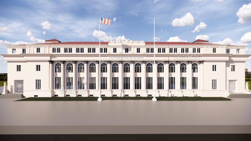
The architectural intricacy of the David W. Dyer Federal Building presents modeling difficulties because of its geometric components and decorative architecture. The BIM model was developed in LOD 400 to overcome these problems. BIM modeling was done using Autodesk Revit, with horizontal reference planes set up based on reference points such as ground level, the top of perimeter walls, and roof height. This ensured that the developed Revit model was of the utmost accuracy and precision.
From a 3D parametric model, BIM modeling automatically creates two-dimensional drawings for geometric, material, and construction descriptions of items. Information type and quantity have a direct relationship with the level of detail (LOD) attained, with each object given its geometrical and material characteristics as well as its functions and surface area.
Advantages of BIM implementation for the Dyer Building Reconstruction Project
BIM is a useful tool for maintaining government buildings, historic buildings, and worn-out infrastructure. Compared to manual surveys, which were slow, laborious, and frequently inaccurate decades ago when point cloud modeling wasn’t available, its approach to documentation and overall work process is superior.
- Precision and Accuracy: 3D laser scanning, thanks to intelligent programming, can capture invisible details, capturing millions of points per minute and spinning faster. This eliminated human error, resulting in the most accurate digital representation of the Federal building, ensuring its efficiency and accuracy.
- Time-saving approach: This project’s area was 162,250 sq. ft., thus manually surveying it and writing the resulting reports would take a very long time. By using point to cloud, the site team could survey the property faster and produce setting out drawings with less effort.
- Common Data Environment: The success of the project as a whole was increased by the effective integration of diverse information about the building into a single digital environment using the Scan-to-BIM approach. This ensured accurate, up-to-date documentation and appropriate building management over time.
Challenges Faced
Throughout the scanning process, processing large data sets was laborious, and modeling some historical architectural ornamentation details was complex. To meet the expectations of the heritage business, independent parametric object libraries for historical structures are necessary, which highlight the need for more structured BIM software. Nevertheless, BIM team at MaRS Trans USA effectively overcame these difficulties and provided a precise Scan to BIM Revit model.